BROOKLYN-USA.ORG 13
There’s A Map(p) For That
Maps show us where we are and
where we need to go. In Brooklyn Borough
Hall’s Topography Bureau, known
affectionately in-house as “Topo,” tens
of thousands of maps serve as a direct
link to our past and bring history to life.
The New York City Charter mandates
that each of the five borough presidents
maintain a topographical bureau and
borough engineer. Topo’s primary function
is maintaining the official borough
map for street improvements. Additionally,
if an alteration is made by the City
Planning Commission’s ULURP (Uniformed
Land Use Review Procedure)
mappings, Topo is required to review the
map change to ensure that it conforms
to office standards. In fact, if you’ve ever
wondered how Brooklyn’s buildings and
homes acquired their addresses; how
its avenues, streets, and various thoroughfares
got their names; or what on
Earth ever happened to Avenue G or
Avenue Q — those are all functions of
Topo, too.
“Maps are serious business at
Brooklyn Borough Hall,” said Borough
President Adams. “Every sidewalk and
street you walk on, every address that
you pass in your daily travels, every
backyard you toss a football around in —
there is not a single inch of our borough
that Topo has not carefully examined
and surveyed.”
In addition to helping 400-500 constituents
each month, including architects,
businesses, homeowners, surveyors,
and tenants, Borough President
Adams’ Topo has charted some new territory,
so to speak. The office has verified
more than 150 Build It Back applications
for the New York City Mayor’s Office of
Recovery and Resiliency (ORR) to rebuild
homes decimated by Superstorm
Sandy in Brighton Beach, Canarsie, Coney
Island, Gerritsen Beach, Manhattan
Beach, Sea Gate, and Sheepshead Bay.
It has de-mapped and re-mapped Coney
Island streets in order to create new
parkland for the famed amusement
district, and it has advanced waterfront
access in Greenpoint through new mapping.
Its work has helped make possible
herculean efforts such as the expansion
of Bushwick Inlet Park, which Borough
President Adams was key in championing
alongside community advocates.
Borough President Adams, an enthusiastic
champion of the digital age,
decided at the onset of his administration
that he would catapult the archaic
maps of Topo into the 21st century by
digitizing each one while preserving
our borough’s unique and storied history.
For a bureau that oversees more
than 30,000 cartographic records dating
back prior to the onset of the Civil
War, this was no small feat, but one in
which he and his dedicated Topo team
saw through to completion. This project
is continually updated as the number of
maps increase due to the ever-changing
vicissitudes of the official City map.
Topo has also branched out into fields
of education. Since 2014, Topo has been
working with students from the Williamsburg
High School for Architecture and
Design, teaching them how to read maps
and, with staff supervision, update them
accordingly. Borough President Adams
instituted the internship program as an
opportunity to create new career paths
for local youth, providing them with invaluable
access to tools in fields such as
construction and engineering.
Topo is where all of Brooklyn’s roads
— and maps — lead, figuratively speaking.
Its office hours are Mondays to
Fridays from 9:30 AM to 12:00 PM and
from 1:00 PM to 3:00 PM.
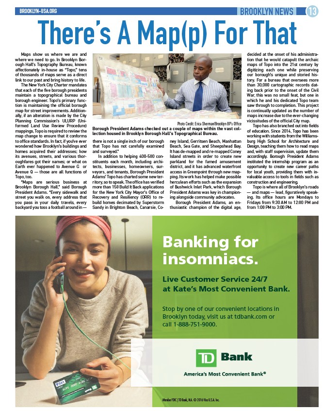
Photo Credit: Erica Sherman/Brooklyn BP’s Office
Borough President Adams checked out a couple of maps within the vast collection
housed in Brooklyn Borough Hall’s Topographical Bureau.
BROOKLYN NEWS
Banking for
insomniacs.
Live Customer Service 24/7
at Kate’s Most Convenient Bank.
Stop by one of our convenient locations in
Brooklyn today, visit us at tdbank.com or
call 1-888-751-9000.
Member FDIC | TD Bank, N.A. © 2016 Visa U.S.A. Inc.